1. Summary
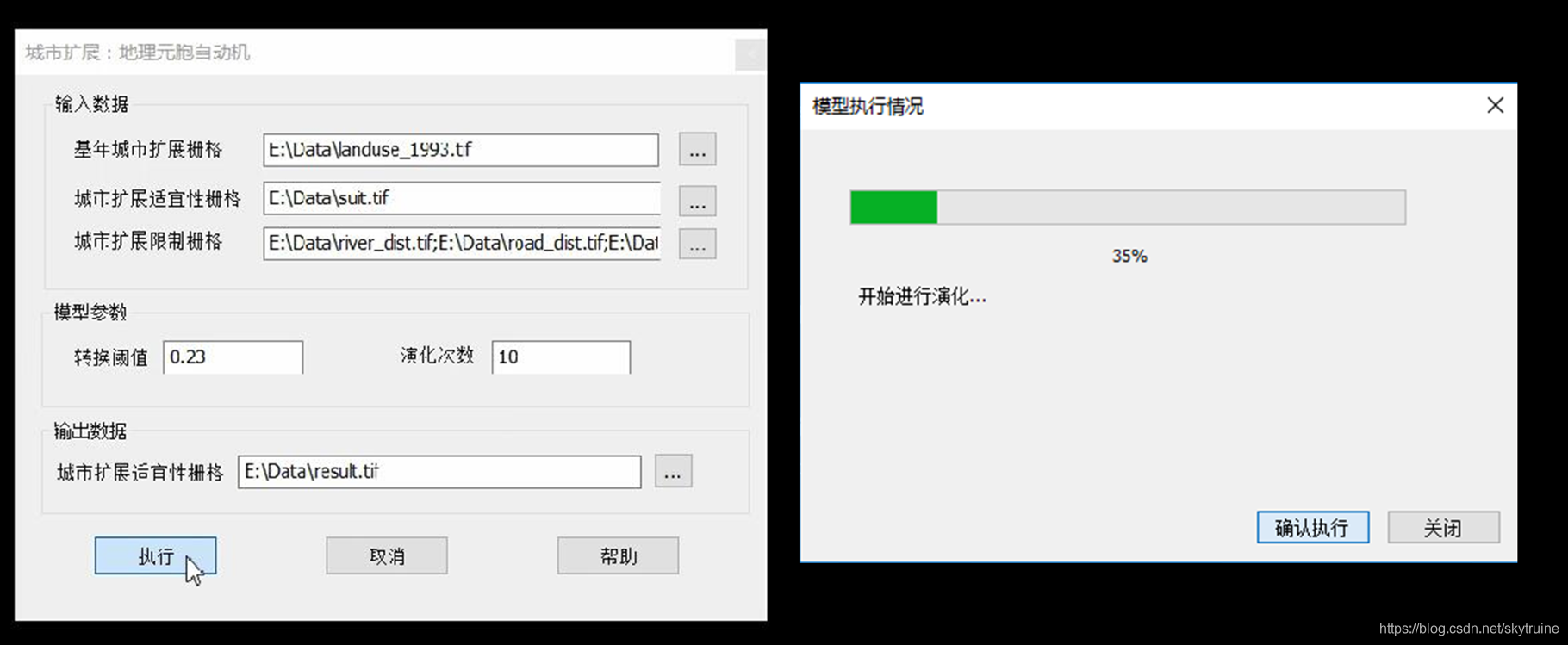
I was the key member of the development team of NGC-IAS (Integral Analysis System of National Geographical Conditions). As a large GIS analysis system developed from the bottom, NGC-IAS consisted of 11 independent toolboxs, each of which offers multiple computing functions, and I was independently responsible for the development of land expansion simulation toolbox and landscape index calculation toolbox. The system has been put into use in geographic information related departments of Beijing, Shanghai, Guangzhou, Shenzhen, Chongqing et al., and effectively improves the working efficiency of national geographical conditions analysis.
2. Technical Framework
Type: PC (Large-scale GIS system); GUI: Qt C++; Algorith: C++.
3. Interface and functions
Toolboxs in NGC-IAS:
- Boundary identification of stretch zone;
- Spatial division of urban and rural area;
- City cluster and metropolitan area identification;
- Urban landscape and compactness calculation; (In Charge)
- Land use benefit calculation;
- Calculation of land use mixing degree;
- Calculation of Road network structure characteristics;
- Analysis of road network development;
- Urban expansion simulation; (In Charge)
- Functional area identification;
- Analysis of public resource allocation.


-
Previous
Luoyou: Smart campus tour APP -
Next
Air Pollution Perception Bias Based on Social Media: Spatiotemporal Pattern & Mechanism